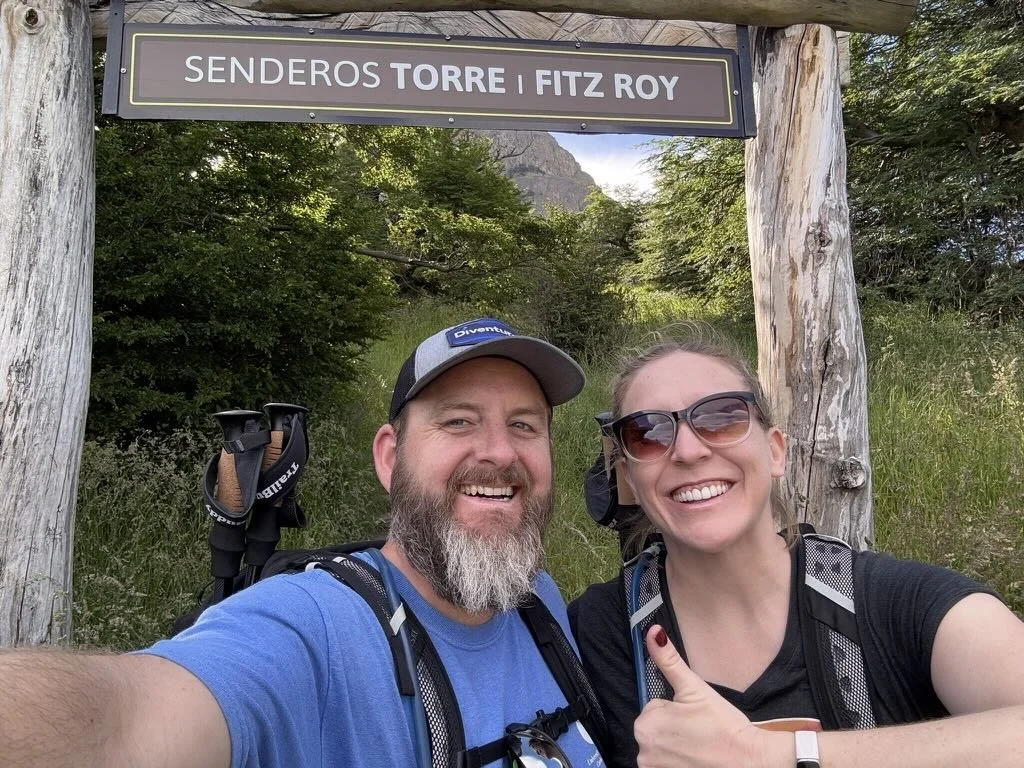
Sometimes It Does Have to Be Hard: Hiking the Laguna de los Tres in Patagonia

The Photo I Couldn't Stop Thinking About
This whole hike started with a stranger's Instagram post.
I scrolled past a photo of a woman sitting in front of an impossibly blue lake stretched out beneath a glacier and jagged mountain peaks. I had no idea where it was, but I couldn't stop thinking about it.
I didn't know the mileage. I didn't know the elevation gain. I didn’t even know what country it was in.
I just knew I needed to stand in that spot and see it with my own eyes.

When I started planning a trip to Patagonia, it was because of this view. I wasn’t sure if my son was too young. If it would be too rugged. It was hard to find information about visiting Patagonia with kids. As it turns out, Patagonia has plenty of incredible kid-friendly hikes and other unforgettable experiences. But this hike? This one was hard. And it was absolutely worth it.
- Location: Los Glaciares National Park, El Chaltén, Argentina
- Trailhead: Starts directly from town—no shuttle needed.
- Length: About 15 miles (about 24 km) round trip from El Chaltén to Laguna de los Tres and back. It takes about 7-9 hours.
- Elevation gain: Approximately 3,000 ft (~900 m), with most of the climbing concentrated in the final kilometer.
- Difficulty: Moderate for most of the trail, but genuinely strenuous during the final push, which is steep, loose, and often windy.
- Good to know for families: Kids and grandparents can enjoy much of the Laguna de los Tres trail, while the final climb is better suited to older children and adults. Looking for a shorter adventure? At the main trail junction, head left toward Laguna Capri for a beautiful 6.2-mile (10 km) out-and-back hike with approximately 1,300 feet (400 m) of elevation gain. It's a wonderful family-friendly option, with scenic picnic spots and a lakeshore where kids can splash in the water on warm days.
- Park pass: Required. Purchase it online before your visit through Argentina's National Parks website and keep it on your phone—you'll need to show it at both the entrance and the exit.
We Had a Plan... and a Backup Plan
One of the great things about hiking Laguna de los Tres was that the traditional path starts right from town.
There was no shuttle to catch or trailhead to drive to. We simply walked out of El Chaltén with our daypacks and headed toward the mountains.
By the time we arrived in Patagonia, our son had been training for about six months to hike the Grand Canyon. We'd spent months hiking together, gradually increasing both mileage and elevation, so this felt like another opportunity to put that training to use.
Even so, I wasn't entirely sure how the day would go.
Fifteen and a half miles is a long hike for anyone, especially an eight-year-old.
And if I'm honest, I wasn't entirely sure what I was getting myself into. We'd read enough to know the final climb was steep and loose, and I wasn't sure whether it would feel as hard as people described.

All four of us started the hike together, with a plan to adjust along the way if we needed to.
Thankfully, we had an incredible backup plan. We agreed we'd hike together as long as everyone was having fun.
If the final climb felt like too much, my mother-in-law would head back with our son while my husband and I continued to the lakes.
Through the Forest
One thing that surprised me was how much of the hike winds through the forest.
Looking at photos online, I'd imagined nonstop mountain views, but much of the first section is shaded by trees. The trail climbs steadily almost from the very beginning, but it never felt especially steep. It was the kind of climb where you knew you were gaining elevation, but you could still settle into a comfortable rhythm.
Every so often the trees opened just enough to reveal another glimpse of Fitz Roy and other area glaciers and rivers before the trail disappeared back into the woods.

One of the first big views of the day, popping out of the forest to look out over the Río de las Vueltas valley as we climbed away from El Chaltén.
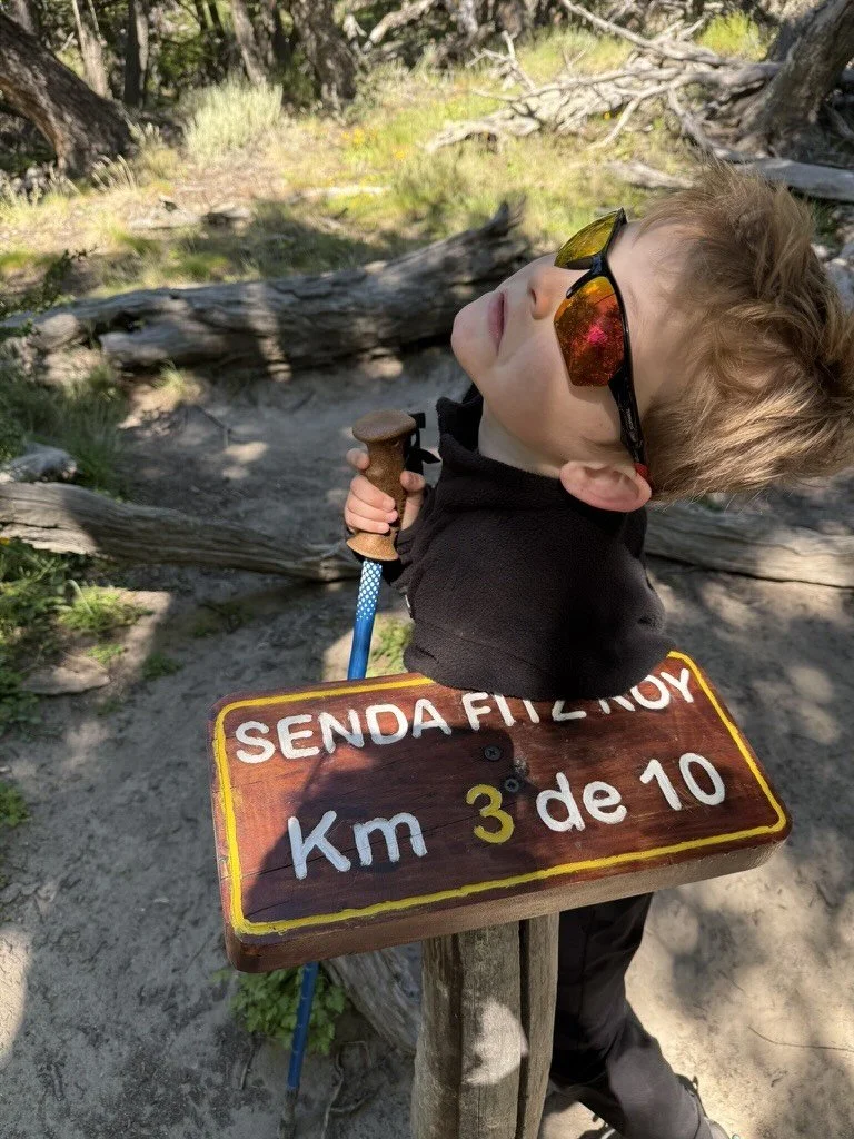
By kilometer three, his excitement for the signs had evolved into increasingly dramatic reenactments of exhaustion.
Along the way, kilometer markers counted down the distance remaining, and we stopped for pictures at almost every one.
My son enjoyed increasingly exaggerated pouts and theatrical displays of exhaustion every time we pulled out the camera. Looking back at those photos still makes me laugh because, despite the performance, he actually hiked incredibly well.
Like any kid tackling a long hike, he got tired, but he always found another gear and kept going.
The Right Fork
When we reached the main trail junction, we chose the right-hand fork toward Mirador Fitz Roy, planning to return on the left-hand trail past Laguna Capri and make the hike into a loop.
I'm really glad we did.
The short walk to the mirador was absolutely worth it. Mount Fitz Roy was trying to peek out of the clouds, and we got our first truly dramatic views of the mountain.

The whole crew at the mirador. Still feeling pretty good about our life choices at this point. The view helped.
Into the Valley
After leaving the mirador, the trail eventually opened into a broad, relatively flat valley. After so much steady climbing through the forest, it felt good to walk across gentler terrain for a while, with the mountains growing larger ahead of us.
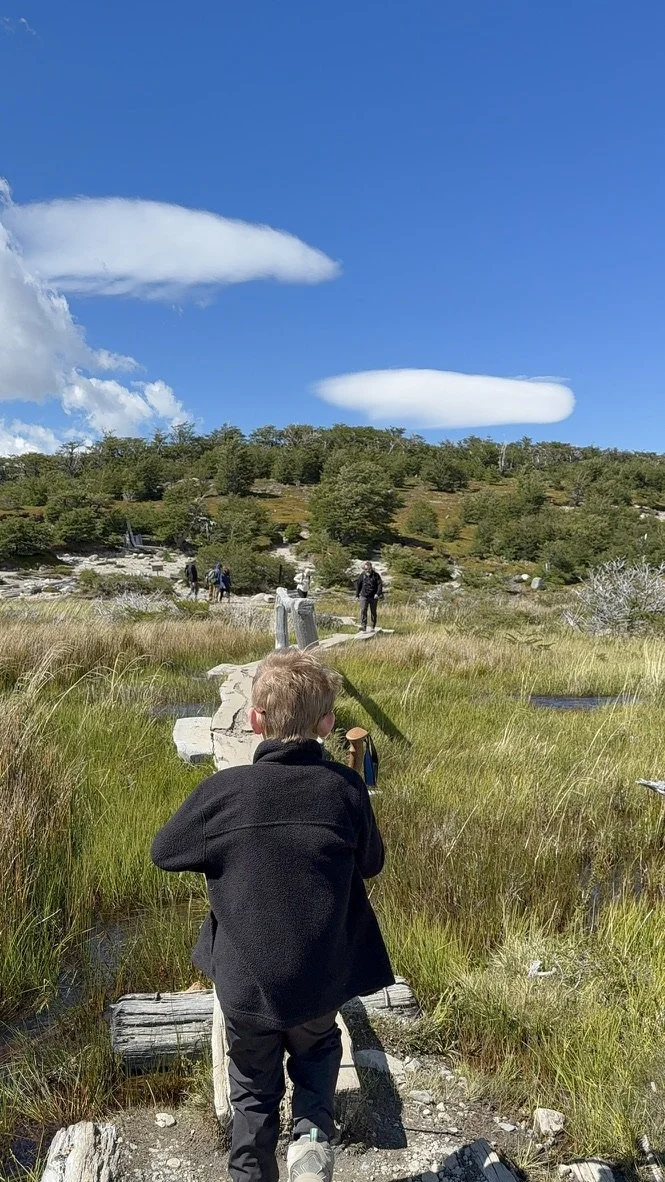
The trail eventually opened into flatter terrain, with boardwalks carrying us across the wettest sections.
By this point, though, our son was starting to run out of steam.
The dramatic kilometer-marker photos were becoming a little less dramatic and a little more genuine by kilometer seven. He was still moving forward with a great attitude, but we could tell the miles were catching up with him.
Eventually we reached Poincenot Campground at about 5.5 miles in, where we found a shady spot for lunch. After several hours on the trail, the break was exactly what we needed. We also appreciated having bathrooms before tackling the final climb.
As we sat eating lunch, our backup plan became the plan.
Our son had done a fantastic job on the hike, but by that point he was starting to think about the long walk back to town. The idea of adding the steep final climb to Laguna de los Tres—and then having to come all the way back down again—wasn't sounding nearly as appealing.
So he and Grandma decided to head back toward El Chaltén while my husband and I continued toward the lakes.
I honestly think he probably could have made it to the top. But I also think he made the right decision. He finished the day proud of what he'd accomplished instead of pushing himself to the point where the hike became miserable. Thanks to Grandma, everyone got the adventure that was right for them.
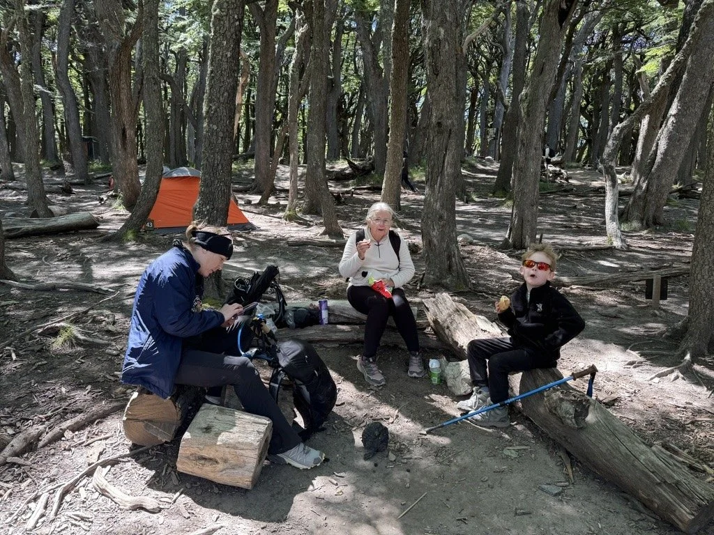
Enjoying a shady lunch at the Poincenot Campground and consulting our AllTrails map to decide who would make the final push to the top.
The Final Kilometer
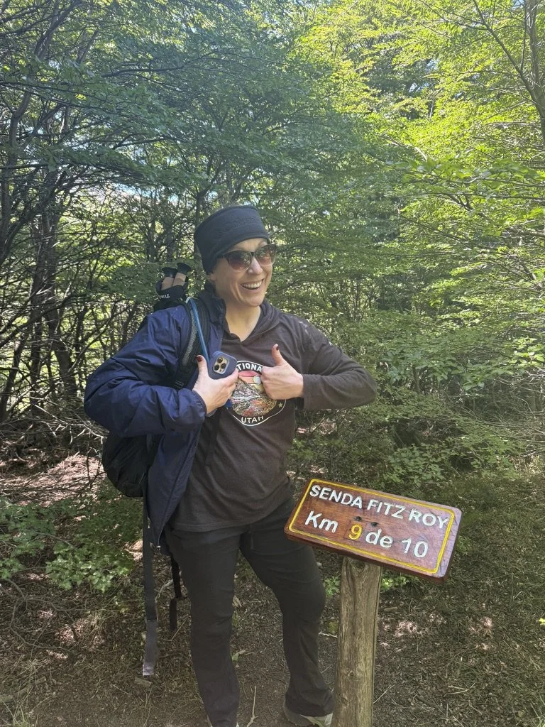
At kilometer nine, before the trail changed completely.
Everything I'd read about the final climb was true.
After miles of gradual incline, the trail suddenly changes. The last kilometer climbs straight up a steep moraine covered in loose rock and scree. It was probably the steepest sustained section of trail I've ever hiked.
This was the first time all day that I felt like I had to work for every step. I wish I had some pictures to share, but we were both too focused on making it to the top.
Our trekking poles made a tremendous difference. They helped on the climb up, but I appreciated them even more on the descent when every loose rock seemed determined to slide out from under my feet.
Just when I thought we'd finally reached the top, the trail rounded a corner.
For one wonderful second, I thought we were done.
Instead, there was one last steep stretch waiting for us.
I remember laughing as I heard the guy hiking ahead of me drop a heavily accented f-bomb when he saw the actual final assent. Seemed about right.
The View I'd Been Dreaming About
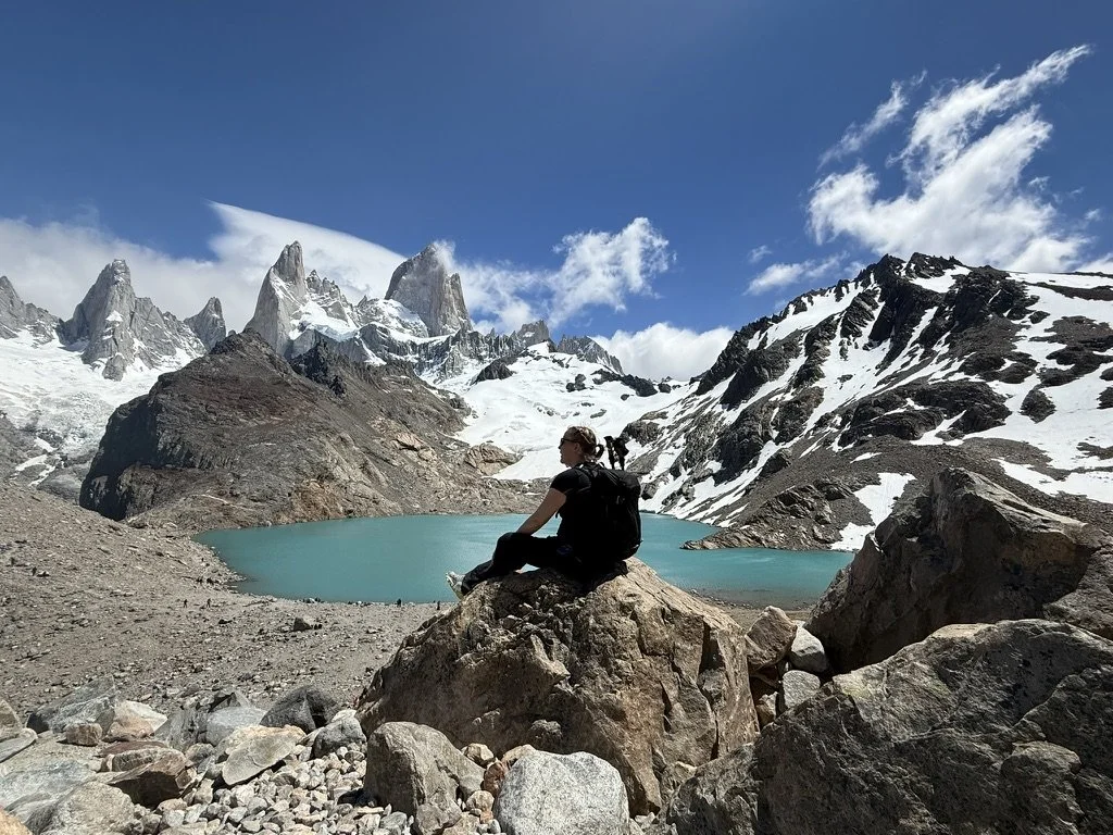
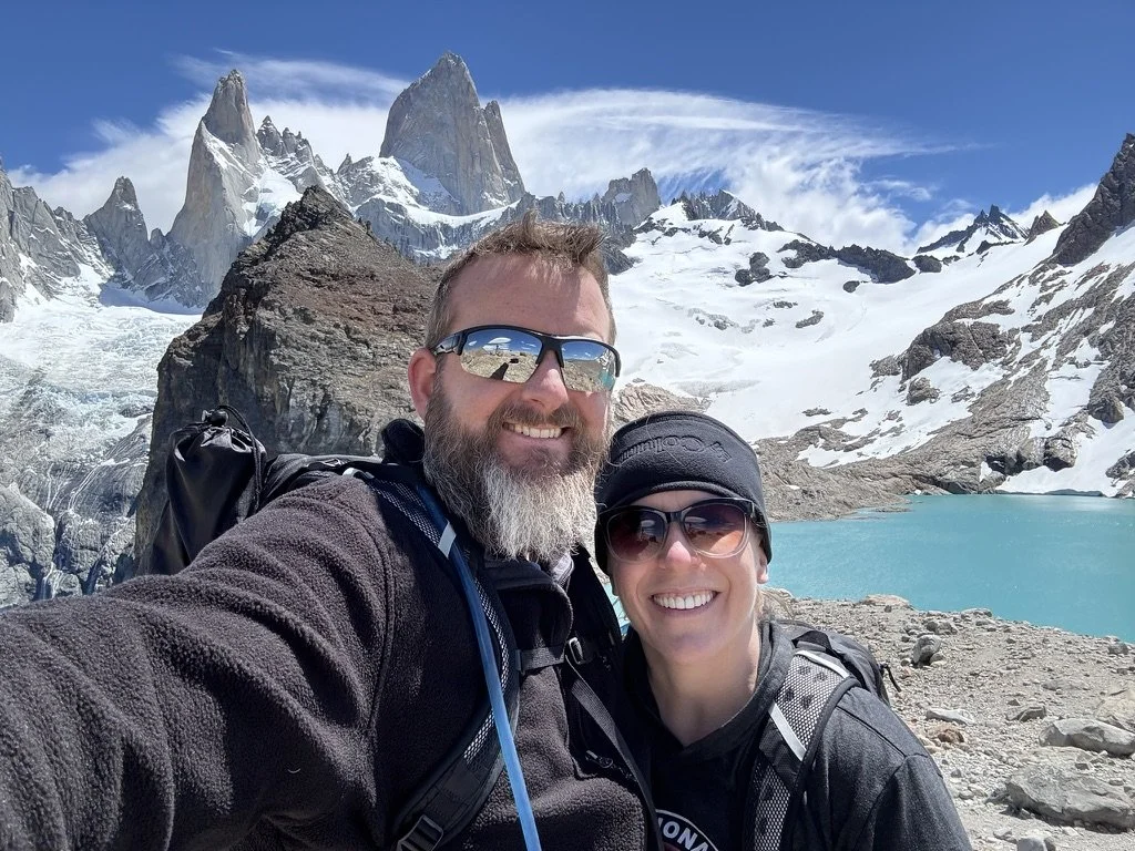
The view that inspired me to travel to the end of the world. We finally made it to Laguna de Los Tres.
And then, finally, we were there.
As you crest the top of the moraine, the trail suddenly opens and you look down at Laguna de los Tres.
The first thing I noticed was the color of the lake. I'd wondered whether the Instagram photos had exaggerated it, but they hadn't. It really was that blue.
Most hikers stopped at the overlook, took a few photos, and turned around. Many never even walked down to the lake. Could you imagine?
We climbed over toward the viewpoint overlooking Laguna Sucia, where there were far fewer people. The wind was fierce, and at one point I had to brace myself against the rocks while waiting for a gust to pass before continuing.
Behind it, the glacier spilled down the mountainside, feeding waterfalls into the lake below. It almost didn't seem real.
There, away from the crowd at the overlook, we found a rock and just sat together for a while.
I remember turning to my husband and saying,
"It's amazing there are places like this you can walk to in the world."
We found a quiet spot between the two lakes and sat together for a while.
The Walk Back
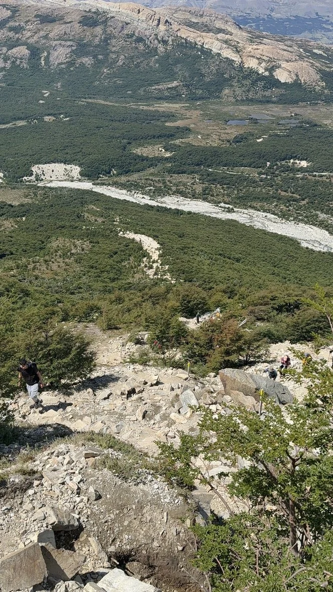
The final kilometer from above. The climb was hard; getting back down was its own challenge.
The hardest part of the hike wasn't quite over.
I found the descent more mentally tiring than the climb because every step required paying attention to where I was putting my feet. The loose rock and scree made it easy to lose your footing, and I was grateful we'd brought trekking poles.
Once we reached the bottom of the moraine, though, I was surprised by how good I felt. I'd expected that final climb to leave me completely exhausted, but once the technical section was behind us, I still had plenty of energy for the hike back.
At the main junction, we took the fork toward Laguna Capri to complete the loop rather than retracing our steps.
I'm so glad we did.
Laguna Capri ended up being one of my favorite surprises of the day. Families were spread out along the shoreline enjoying picnics while children splashed in the water. After the excitement and wind at Laguna de los Tres, everything felt calmer here.
I wished we'd planned more time at the lake. If I were doing this hike again, I'd pack a picnic and build in an extra hour to relax at Laguna Capri before making the final walk back to El Chaltén.
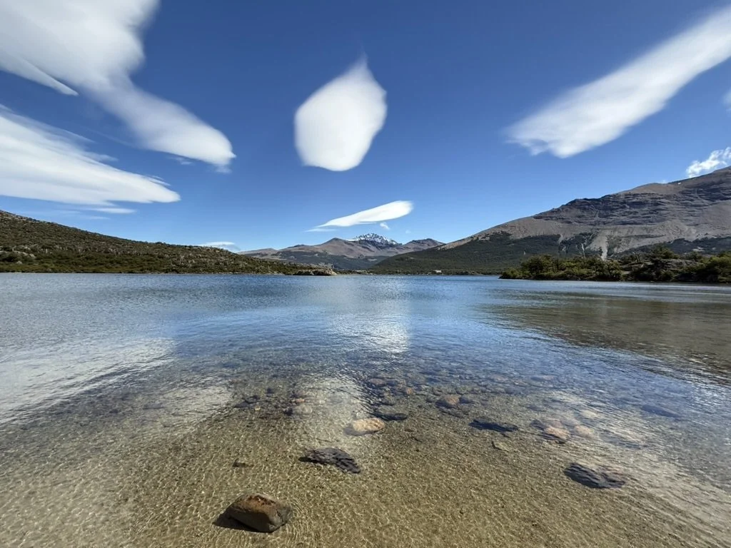
A perfect quiet moment at Laguna Capri, under some of Patagonia’s impossibly dramatic skies
Sometimes It Does Have to Be Hard
This hike wasn't the most memorable day in Patagonia because it was the most beautiful.
It stands out because I wondered if my son could do it.
Wondered if I could do it.
Adjusted our plans when we needed to.
And then spent a few moments sitting beside one of the most incredible places I've ever seen.
Sometimes the best travel memories come from choosing to do hard things.
Back where we started, a lot more tired, and very glad we went .
Things You Should Know Before You Go
A few practical notes before you lace up:
You don't have to start in El Chaltén. We loved walking from town because it made the whole day feel like an adventure, but if you'd rather shorten the hike, you can take a shuttle or taxi to Hostería El Pilar and join the trail there.
Don't underestimate the sun. Even when the wind keeps you cool, the Patagonian sun is strong. Sunscreen was a must.
Dress in layers. We had a calm day until we reached the summit, where the wind reminded us exactly where we were. Conditions can change quickly.
Wear shoes with good traction and bring trekking poles. The final climb—and especially the descent—is on loose scree. Trekking poles made a huge difference in helping me keep my footing on the way down.
Carry more water than you think you'll need. We each packed three liters and were glad we did. Plenty of hikers filtered water from the streams, but we chose to carry everything with us instead.
Take the right fork to the Mirador on the way out and return via Laguna Capri. It lets you experience both viewpoints without retracing your steps, and I thought it made for a more interesting day.
Subscribe for realistic itineraries, honest stories, and practical advice for exploring the world with kids — without pretending family travel is effortless or waiting until we’re completely sure we can do it.
Subscribe Now

About Christal
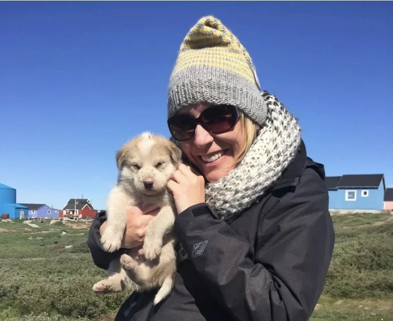
Snuggling sled dog puppies in Ilulissat, Greenland
I’m a clinical psychologist, professor, and writer who believes in resisting hustle culture and finding awe through slow, meaningful travel with my family.
I’ve explored five continents, often blending work and play through teaching abroad and cultural immersion.
I created We Went Anyway as a space to share stories about choosing presence over perfection and finding joy in a full, connected life through adventure — big and small.
When I’m not writing or hiking, you’ll find me sipping peppermint tea on the porch with friends, building Legos with my son, watching design videos to guide the slow remodel of our 119-year-old home, or planning the next family trip from our home base in Kentucky.